


Could the enclosure shown on this 1953 aerial photograph of the summit of Cape Dauphin be a fire break built in 1952 by a volunteer fire brigade as a way of containing a forest fire and not, as suggested in the book, the remains of town wall?
Logic suggests that this wide line of stones, as shown in these two photographs, was not built as a fire break. As firefighters who have seen the photographs have said, it would be very unlikely for even the largest and most well equipped firefighting team to construct a fire break out of large stones in order to fight a raging forest fire. What is more likely is that the volunteer brigade from the 1952 fire plowed over the existing wide stone base of the wall, clearing it and leaving it exposed to act as a firebreak. That is why it is visible in this 1953 aerial. Though the stone remains of the wall may have been useful for fighting the forest fire, the volunteer fire fighters were not the original builders.
Moreover, the aerial photograph shows that a second linear feature, possibly a second wall, may have existed on the site. It is highlighted in the second aerial photograph. There is also a round element in this wall-like feature. This is the way Chinese walls were sometimes built, as shown in this Chinese illustration of a typical walled town, with two walls parallel to each other with round entrance gates.
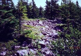
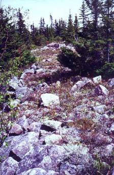
The wide line of stone that appears to surround the site and may have been the base of an earth wall.
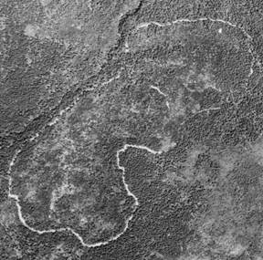
An aerial photograph of the site taken in June 1953.
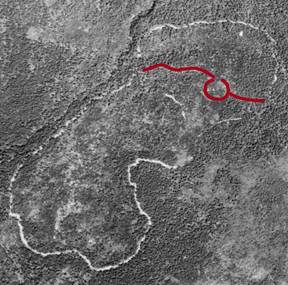
The same 1953 aerial with what may have been a secondary wall highlighted.
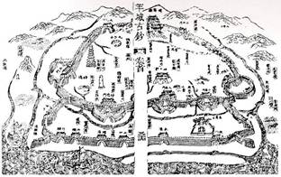
A Chinese illustration showing a town with parallel walls and round entrances.
These walls would have been built of hardened earth with stone used only as the base